How To Use Google Maps When Travel?
Google Maps is a useful tool for travellers who are looking to plan their journey and make the most of their vacation. With its intuitive mapping capabilities and navigational features, you can easily find routes and get accurate directions to your destination. On top of that, Google Maps supports a wide array of transportation options — from cars to bicycles to public transport — so you can plan your trip according to your preference. With Google Maps, travelling has never been easier!
Google Maps’ Features To Enhance Your Travel Experience
Real-time traffic updates: Google Maps provides real-time traffic updates, which can help travellers avoid traffic congestion and save time on their journey. The app can also suggest alternative routes if heavy traffic is on the intended path.
Public transit information: Google Maps offers public transit information, including schedules, routes, and fares. This feature can be especially useful for travellers who are unfamiliar with a new city or who prefer to use public transportation.
Offline maps: Google Maps allows users to download maps for offline use, which can be helpful when travelling to areas with limited internet access. With offline maps, travellers can still access directions and explore new areas without worrying about data usage or connectivity issues.
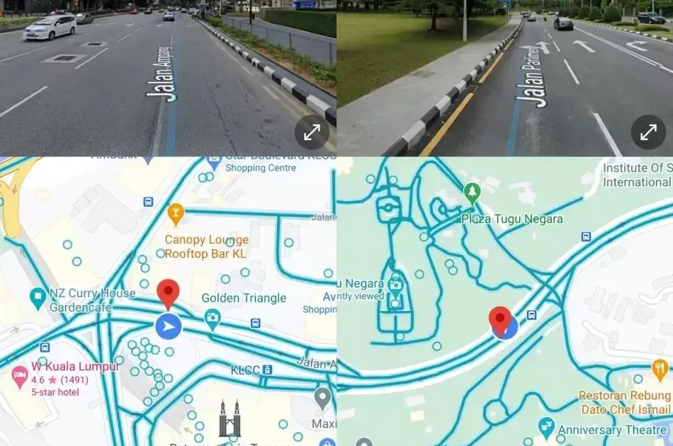
Street View: Google Maps’ Street View feature allows users to see a 360-degree view of their surroundings, which can be helpful for getting a sense of a new location before arriving. Travellers can use this feature to explore a new neighbourhood, find landmarks, or even check out the inside of a restaurant or hotel.
Explore feature: The Explore feature on Google Maps helps travellers find nearby restaurants, attractions, and other points of interest. This feature can be especially useful for finding hidden gems in a new city or for discovering popular local spots that may not be listed in a guidebook.
Utilize Google Maps To Your Advantage
- Save maps for offline use
: Before leaving for a trip, save the maps of the area you’ll be travelling to for offline use. This will allow you to access directions and explore new areas without worrying about data usage or connectivity issues.
- Use the Explore feature
: The Explore feature on Google Maps is a great tool for finding nearby restaurants, attractions, and other points of interest. Simply tap on the Explore tab, and Google Maps will provide recommendations based on your location.
- Set custom labels for favourite spots
: If you have specific places you want to visit during your trip, such as a favourite restaurant or attraction, use the custom labels feature to mark them on the map. This will allow you to easily find them again later and plan your itinerary accordingly.
- Use Street View for visual context
: When exploring a new area, use the Street View feature to get a better sense of the surroundings. This can help you navigate more confidently and make informed decisions about where to go next.
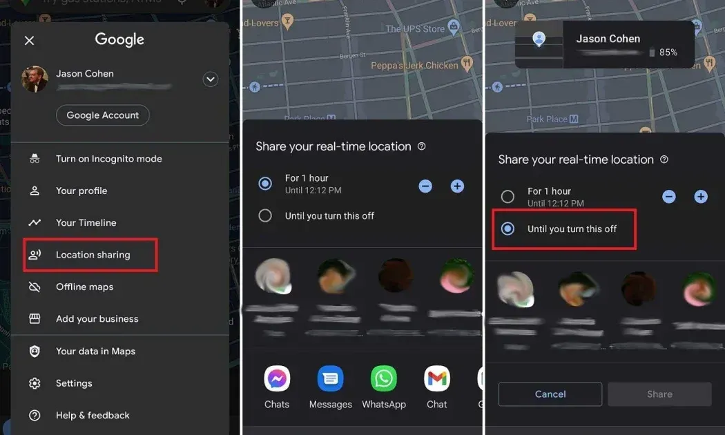
- Enable location sharing : If you’re travelling with others, consider enabling location sharing in Google Maps. This will allow you to easily keep track of each other’s locations and ensure that everyone stays on the same page.
Look Forward to New Features Coming Soon!
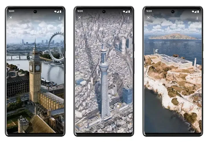
Immersive view
Google Maps has introduced a new feature called Lens, which allows users to access a 3D immersive view of their surroundings within the app. To use Lens, users activate it in the app and point their camera at their surroundings to get an immersive 3D view of the area. The feature is particularly useful for travelers as it can help them get a better sense of their location and find nearby points of interest. The Google Maps Lens feature on immersive view is an exciting development for the app, providing users with a more interactive and engaging way to explore their surroundings.
Google Lens Multisearch Feature
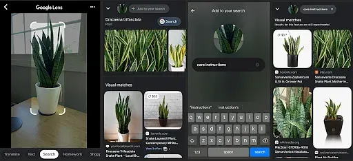
The Multisearch feature from Google Search allows users to access multiple search results from different categories, such as images, news, videos, and shopping, all in one place. Although Google Maps does not currently have this feature, its integration into other Google apps, including Maps, could potentially enhance the user experience by providing a more comprehensive view of information related to a particular location or point of interest. Overall, Multisearch is a useful tool for accessing multiple types of search results efficiently and could have exciting implications for future developments in Google Maps.
Live View
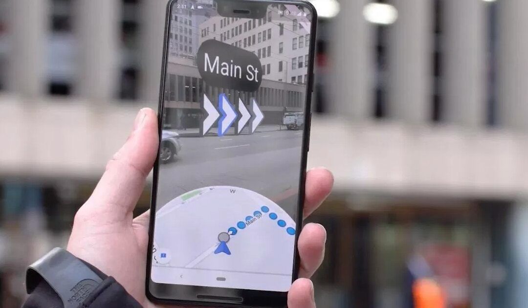
Live View is one of the most exciting and innovative features within Google Maps. This augmented reality (AR) technology uses the phone’s camera and location data to provide real-time directions overlaid onto the camera feed, making it easier for users to navigate and find specific points of interest. With Live View, users can simply hold up their phone and see arrows and directions overlaid onto a live camera feed of their surroundings, providing an immersive and interactive experience.
Live View is particularly useful for travellers exploring unfamiliar places or trying to navigate complex areas. It’s an effective tool for finding specific points of interest, such as a particular building or store, within crowded areas. Although the feature is currently only available in select cities and locations, Google is working to expand its availability. Live View is just one example of Google’s commitment to using innovative technology to make information and navigation more accessible and intuitive for its users.
Show Off Your New Skills!
In conclusion, Google Maps is an incredibly useful tool for travellers looking to navigate unfamiliar places and make the most of their time on the go. From real-time traffic updates and public transit information to offline maps and immersive view features, there are countless ways to use Google Maps to enhance your travel experience. So the next time you’re planning a trip, be sure to explore all of the features that Google Maps has to offer and use them to your advantage. Whether you’re trying to find the best local cuisine or simply get from point A to point B, Google Maps can help you get there with ease.
In the meantime, why not put these tips into practice and plan your next adventure using Google Maps? With so many exciting features and tools at your fingertips, you’re sure to discover something new and exciting every step of the way. So go ahead and explore, and see where Google Maps can take you!
The post How To Use Google Maps When Travel? appeared first on Blog.


